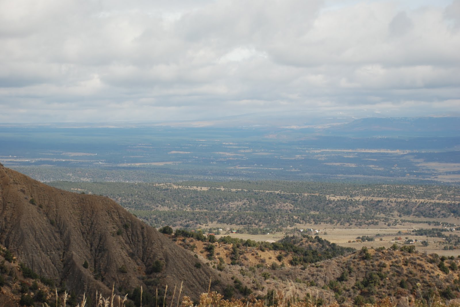
Montezuma Valley, below, and Mesa Verde, where I stand, were once part of the Ancestral Puebloan homelan d. Between AD 600 and AD 1280, hundreds of villages and farming communities thrived on the mesas, plateaus, and canyons that form this landscape. Archeologists estimate that as many as 35,000 Ancestral Puebloans lived in this region during the 1200's. At the start of the 21st century, Montezuma Valley had a population of about 24,000 people.


 Natural Seep Springs
Mancos Shale - Beginning more than 90 million years ago, thick layers of clay and silt were deposited when this region was covered by a shallow inland sea. The soft, easily eroded material is called Mancos Shale.
Point Lookout Sandstone - As the sea temporarily withdrew a little more than 80 million years ago, shallow water beaches and delta sands were deposited. They are now exposed in the cliffs of the Point Lookout Sandstone.
Menefee Formation - About 80 million years ago, as marine shorelines temporarily migrated to the northeast, this area had the relatively flat surface of a former sea bed. Deposits in stream floodplains, swamps, and low lying interstream areas are now seen as sandstone, coal, and wood shales.
Cliff House Sandstone - Beginning a little less than 80 million years ago, the sea once again advanced across the area. In the shallow water, sand was deposited in thick layers, giving rise to the Cliff House Sandstone. More recently, erosion created alcoves that became homes to the cliff dwellers.
Where is the Water?
Moisture, in the form of rainfall or snowmelt, percolates through porous sandstone layers until it reaches a dense, impermeable layer of shale. Prevented from percolating farther downward, the water is forced to the rock surface resulting in a seep spring in the canyon wall.
Through Mesa Verde, seep springs can be found at the base of the Cliff House Sandstone and Point Lookout Sandstone formations. These springs provided a ready source of fresh water for the Ancestral Pueb loans. Where they lacked such springs, villagers had to collect water from potholes, creek bottoms, distant year-round springs, or build reservoirs.
Natural Seep Springs
Mancos Shale - Beginning more than 90 million years ago, thick layers of clay and silt were deposited when this region was covered by a shallow inland sea. The soft, easily eroded material is called Mancos Shale.
Point Lookout Sandstone - As the sea temporarily withdrew a little more than 80 million years ago, shallow water beaches and delta sands were deposited. They are now exposed in the cliffs of the Point Lookout Sandstone.
Menefee Formation - About 80 million years ago, as marine shorelines temporarily migrated to the northeast, this area had the relatively flat surface of a former sea bed. Deposits in stream floodplains, swamps, and low lying interstream areas are now seen as sandstone, coal, and wood shales.
Cliff House Sandstone - Beginning a little less than 80 million years ago, the sea once again advanced across the area. In the shallow water, sand was deposited in thick layers, giving rise to the Cliff House Sandstone. More recently, erosion created alcoves that became homes to the cliff dwellers.
Where is the Water?
Moisture, in the form of rainfall or snowmelt, percolates through porous sandstone layers until it reaches a dense, impermeable layer of shale. Prevented from percolating farther downward, the water is forced to the rock surface resulting in a seep spring in the canyon wall.
Through Mesa Verde, seep springs can be found at the base of the Cliff House Sandstone and Point Lookout Sandstone formations. These springs provided a ready source of fresh water for the Ancestral Pueb loans. Where they lacked such springs, villagers had to collect water from potholes, creek bottoms, distant year-round springs, or build reservoirs.


 A Monument to Time
Deposition
During the late Cretaceous period (about 90 million years ago) much of North America, including southwest Colorado and the present Rocky Mountains, was covered by a shallow inland sea. Thousand of feet of marine and shoreline sediments were deposited and now form the rocks of Mesa Verde: shale, sandstone, coal, and siltstone.
Uplift and Erosion
Within the last 65 million years, the Colorado Plateau and Rocky Mountains were formed by a series of uplifts that gradually raised the land thousands of feet above sea level. Erosion probably kept pace with the uplift as streams flowed south and west from the rising La Plata and San Juan Mountains. These ancient streams cut deep canyons across the gentle slopes of Mesa Verde dissecting it into the smaller, fingerlike mesas on the southern end of the park.
Over millions of years, the Mesa Verde formations were raised almost 8000 feet and gently tilted to the south. These same sedimentary rocks eroded off the uplifted mountains, leaving a 1500 foot escarpment between Mesa Verde and the La Plata Mountains.
A Monument to Time
Deposition
During the late Cretaceous period (about 90 million years ago) much of North America, including southwest Colorado and the present Rocky Mountains, was covered by a shallow inland sea. Thousand of feet of marine and shoreline sediments were deposited and now form the rocks of Mesa Verde: shale, sandstone, coal, and siltstone.
Uplift and Erosion
Within the last 65 million years, the Colorado Plateau and Rocky Mountains were formed by a series of uplifts that gradually raised the land thousands of feet above sea level. Erosion probably kept pace with the uplift as streams flowed south and west from the rising La Plata and San Juan Mountains. These ancient streams cut deep canyons across the gentle slopes of Mesa Verde dissecting it into the smaller, fingerlike mesas on the southern end of the park.
Over millions of years, the Mesa Verde formations were raised almost 8000 feet and gently tilted to the south. These same sedimentary rocks eroded off the uplifted mountains, leaving a 1500 foot escarpment between Mesa Verde and the La Plata Mountains.


No comments:
Post a Comment